
NAVIGATION
research interests
education
professional appointments
publications
maps
GEOLOGICAL SURVEY
home
publications
people
MEWBOURNE COLLEGE
home
academics
student services
alumni
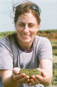
Julie M. Chang
Geologist IV
Address:
The University of Oklahoma
Oklahoma Geological Survey
100 East Boyd Street, Suite T205
Norman, Oklahoma 73019
Email: jmchang@ou.edu
Office: 405.325.7055
Fax: 405.325.7069
Research Interests:
Mapping
Igneous and metamorphic petrology
Tectonics
Education:
Ph.D., Geology, University of Texas at El Paso, 2006
M.S., Geology, University of Arizona, Tucson, 2002
B.S., Geology, Montana State University, Bozeman, 2000
Professional Appointments:
Geologist, Oklahoma Geological Survey, Norman, Aug. 2008-Present
Postdoctoral Researcher, Montana State University, Bozeman, June 2007-May 2008
Postdoctoral Researcher, Cornell University, Ithaca, NY, Jan.-May 2007
Lab Technician, EMSL Analytical, Inc., Libby, MT, June-Sept. 2002
Publications:
Chang, J.M., and Smith, C.G., 2014, OGS Director G. Randy Keller is retiring: Oklahoma Geology Notes, v. 74, no. 3, pp. 3-4. [PDF]
Chang, J.M., 2014, Summary of new heat production calculations in Oklahoma: Oklahoma Geology Notes, v. 74, no. 1, pp. 5-11. [PDF]
Chang, J.M., and Stanley, T.M., 2013, 2014 STATEMAP Update: Oklahoma Geology Notes, v. 73, no. 4, pp. 9-11. [PDF]
Chang, J.M., 2012, Heat production in Oklahoma: Old and new data: Oklahoma Geology Notes, v. 72, no. 3, pp. 1-3. [PDF]
Chang, J.M., and Stanley, T.M., 2011, STATEMAP: Mapping the Ardmore 1 Degree Sheet and the Oklahoma Part of the Gainsville 1 Degree Sheet, Oklahoma: Oklahoma Geology Notes, v. 71, no. 4, pp. 4-6. [PDF]
Chang, J.M., Standridge, G.R., and Stanley, T.M., 2011, Oklahoma Geological Survey STATEMAP Project Update: Shale Shaker, v. 61, no. 6, pp. 338-340.
Chang, J.M., 2010, My Favorite Outcrop - Dodds Creek Sandstone, Osage County, OK: Shale Shaker, v. 61, no. 1, pp. 11-14.
Chang, J.M., Feeley, T.C., and DeRaps, M.R., 2009, Petrogenesis of basaltic volcanic rocks from the Pribilof Islands, Alaska, by melting of metasomatically enriched depleted lithosphere, crystallization differentiation, and magma mixing: Journal of Petrology, v. 50, pp. 2249-2286. [Abstract]
Chang, J.M., and Andronicos, C.L., 2009, Constraints on the depth of generation and emplacement of a magmatic epidote-bearing quartz diorite pluton in the Coast Plutonic Complex, British Columbia: Terra Nova, v. 21, pp. 480-488. [Abstract]
Andronicos, C.L., Phipps Morgan, J., Chang, J.M., and Wolf, D.E., 2008, Melt-filled hybrid fractures in the oceanic mantle: Melt enhanced deformation during along-axis flow beneath a propagating spreading ridge: Earth and Planetary Science Letters, v. 273, pp. 270-278. [Abstract]
Hamblock, J.M., Andronicos, C.L., Miller, K.C., Barnes, C.G., Ren, M.-H., Averill, M.G., and Anthony, E.Y., 2007, A composite geologic and seismic profile beneath the southern Rio Grande rift, New Mexico, based on xenolith mineralogy, temperature, and pressure: Tectonophysics, v. 442, pp. 14-48. [Abstract]
Maps:
Stanley, T.M., and Chang, J.M., 2016, Geologic map of the Ada 7.5' quadrangle, Oklahoma, Scale 1:24,000, in progress.
Stanley, T.M., and Chang, J.M., 2016, Geologic map of the Keystone Lake 30' X 60' quadrangle, Oklahoma, Scale 1:100,000, in progress.
Stanley, T.M., and Chang, J.M., 2015, Geologic map of the Roff North 7.5' quadrangle, Pontotoc County, Oklahoma: Oklahoma Geological Survey OGQ-90, Scale 1:24,000. [PDF]
Stanley, T.M., and Chang, J.M., 2015, Geologic map of the Pawhuska 30' X 60' quadrangle, Kay, Noble, Osage, and Pawnee Counties, Oklahoma: Oklahoma Geological Survey OGQ-91, Scale 1:100,000. [PDF]
Chang, J.M., and Stanley, T.M., 2014, Geologic map of the Vanoss 7.5' quadrangle, Pontotoc County, Oklahoma: Oklahoma Geological Survey OGQ-89, Scale 1:24,000. [PDF]
Chang, J.M., and Stanley, T.M., 2014, Geologic map of the Tishomingo 30' X 60' quadrangle, and the Oklahoma part of the Sherman 30' X 60' quadrangle, Atoka, Bryan, Choctaw, coal, Johnson, Love, Marshall, Murray, and Pontotoc Counties, Oklahoma: Oklahoma Geological Survey OGQ-88, Scale 1:100,000. [PDF]
Stanley, T.M., and Chang, J.M., 2012, Preliminary geologic map of the Ardmore 30' X 60' quadrangle and the Oklahoma part of the Gainesville 30' X 60' quadrangle, Carter, Jefferson, Love, Murray, and Stephens Counties, Oklahoma: Oklahoma: Oklahoma Geological Survey OGQ-86, Scale 1:100,000. [PDF]
Stanley, T.M., and Chang, J.M., and Stanley, T.M., 2012, Geologic map of the Jenks 7.5' quadrangle, Tulsa County, Oklahoma: Oklahoma Geological Survey OGQ-85, Scale 1:24,000. [PDF]
Chang, J.M., and Stanley, T.M., 2012, Geologic map of the Kellyville 7.5' quadrangle, Creek County, Oklahoma: Oklahoma Geological Survey OGQ-84, Scale 1:24,000. [PDF]
Chang, J.M., and Stanley, T.M., 2011, Geologic map of the Sapulpa North 7.5' quadrangle, Creek and Tulsa Counties, Oklahoma: Oklahoma Geological Survey OGQ-83, Scale 1:24,000. [PDF]
Stanley, T.M., and Chang, J.M., 2011, Geologic map of the Lake Sahoma 7.5' quadrangle, Creek and Tulsa Counties, Oklahoma: Oklahoma Geological Survey OGQ-82, Scale 1:24,000. [PDF]
Chang, J.M., and Stanley, T.M., 2010, Geologic map of the Pauls Valley 30' X 60' quadrangle, Carter, Cleveland, Garvin, Grady, McClain, Murray, Pottawatomie, and Stephens Counties, Oklahoma: Oklahoma Geological Survey OGQ-81, Scale 1:100,000. [PDF]
Chang, J.M., and Stanley, T.M., 2010, Geologic map of the Sand Springs 7.5' quadrangle, Osage and Tulsa Counties, Oklahoma: Oklahoma Geological Survey OGQ-79, Scale 1:24,000. [PDF]
Chang, J.M., and Stanley, T.M, 2009, Geologic map of the Sapulpa South 7.5' quadrangle, Creek and Tulsa Counties, Oklahoma: Oklahoma Geological Survey OGQ-76, Scale 1:24,000. [PDF]
Stanley, T.M., and Chang, J.M., 2009, Geologic map of the Bixby 7.5' quadrangle, Tulsa County, Oklahoma: Oklahoma Geological Survey OGQ-75, Scale 1:24,000. [PDF]
UPDATED: 13 June 2016